
Schemmer
Newsroom
Before Hiring a Land Surveyor: What You Need to Know
August 20, 2026 • All
Fences, utility poles and cracks in the sidewalk are easy to mistake for property lines. They are not reliable boundary evidence.
A licensed professional land surveyor determines the location of a boundary by reviewing deeds, plats, surveys and other records, then comparing that information with monuments and physical evidence found on the property. Measurements are part of the work, but measurements alone do not settle every boundary question.
If you are buying land, planning improvements or dividing a parcel, it is worth talking with a surveyor early. The type of survey you need will depend on the property, the intended use and the requirements of your lender, title company or local jurisdiction.
When should you have your property surveyed?
A survey may be needed when you are:
- Buying or selling property
- Planning a building, addition, fence or other improvement
- Dividing or combining parcels
- Trying to locate missing property corners
- Addressing a possible encroachment or boundary concern
- Preparing a site for design or construction
- Working through lender or title requirements
- Following the advice of an attorney, architect, engineer or local official
Do not wait until construction is ready to begin. A boundary or title issue discovered late in the process can affect the site plan, permit review or construction schedule.
Land divisions can take time, even when the proposed change looks simple. Splitting off a homesite from a farm, for example, may require a survey, legal description, access review, zoning approval, utility coordination and action by the city or county. The exact process differs by jurisdiction.
What does a professional land surveyor do?
The surveyor’s work depends on the type and purpose of the survey. Services may include:
- Researching deeds, plats, surveys and other records
- Locating existing boundary monuments
- Evaluating conflicting boundary evidence
- Setting property corners when authorized and appropriate
- Preparing plats, maps and legal descriptions
- Locating buildings, pavement, fences and other improvements
- Collecting topographic information for design
- Providing construction staking
- Preparing subdivision plats
- Completing as-built surveys
- Preparing ALTA/NSPS Land Title Surveys
A boundary survey does not automatically include every visible feature on the property. It may not show buildings, utilities, easements, trees, pavement or changes in elevation unless those items are included in the agreed scope.
Tell the surveyor what you are planning to do with the property. A crew needs different information to support a fence installation than it does for a building design, subdivision or commercial real estate transaction.
How does the survey process work?
Most surveys include records research, fieldwork, analysis and preparation of the final documents. The amount of work in each stage depends on what the surveyor finds.
Records research
Work often begins in the office. The surveyor reviews the legal description of the property along with available deeds, plats and prior surveys. Records for adjoining properties may also need to be reviewed.
The goal is to understand how the parcel was created and identify the boundary evidence that should exist in the field. This research may reveal gaps, overlaps or conflicting descriptions that require closer study.
Fieldwork
The field crew searches for existing monuments and collects measurements. Monuments may include iron rods, pipes, concrete markers, stones, disks or other objects called for in the records.
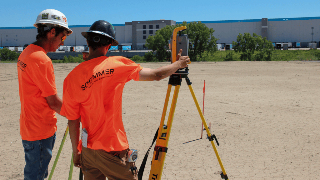
Depending on the scope, the crew may also locate buildings, pavement, fences, visible utilities and terrain. Surveyors use equipment such as robotic total stations, Global Navigation Satellite System receivers and digital data collectors to complete this work.
The equipment provides precise measurements. The licensed surveyor still has to decide how those measurements relate to the deeds, monuments and other evidence. A coordinate from a phone app, online map or county geographic information system is not a substitute for a boundary survey.
Boundary analysis
Conditions in the field do not always match the record documents. A monument may be missing. Two descriptions may conflict. An occupation line, such as a fence, may not agree with the deed dimensions.
When that happens, the surveyor evaluates the available evidence under the laws and standards that apply in that state. Additional research or another field visit may be necessary. Replacing a missing corner is not simply a matter of measuring the deed distance from the nearest convenient object.
Survey documents
Once the work is complete, the surveyor prepares the documents included in the scope. These may include a signed and sealed plat, a legal description, a report, digital files or staking information.
Recording requirements vary by state, jurisdiction and survey type. Ask whether your survey will be filed or recorded and whether you will receive paper, digital or both types of deliverables.
How long will the survey take?
A surveyor usually cannot give a dependable schedule without knowing the property and the requested scope. Several factors can affect the amount of work required:
- Property size and location
- Terrain, vegetation and site access
- Availability of deeds, plats and prior surveys
- Condition of existing monuments
- Conflicting or incomplete records
- Number of adjoining parcels that must be researched
- Municipal review and approval requirements
- Weather and field conditions
- Type of survey and requested deliverables
A small parcel is not always a quick survey. A city lot with conflicting records or missing monuments may require more research than a larger tract with good records and well-preserved corners.
Let the surveyor know about closing dates, design deadlines or public hearing schedules when requesting a proposal. The firm can then tell you whether the requested schedule is realistic.
How do you choose a surveying firm?
Confirm that the survey will be completed under the responsible charge of a professional land surveyor licensed in the state where the property is located. State licensing boards generally provide online license-verification tools.
Relevant experience also matters. A firm that regularly works in the area may already be familiar with local records, review procedures and subdivision requirements. For specialized work, such as an ALTA/NSPS Land Title Survey or a complex land division, ask whether the firm has completed similar projects.
Before authorizing the work, ask:
- What type of survey fits the intended use?
- What will be shown on the final plat or map?
- Will property corners be located or set?
- Are improvements, easements or utilities included?
- What information does the surveyor need from you?
- What conditions could change the fee or schedule?
- Will the survey be filed or recorded?
- Who is responsible for arranging access?
- What will you receive when the work is finished?
Review the proposal carefully. A written scope should identify the services, deliverables, fee basis and any work that is not included.
What should you give the surveyor?
You do not need to assemble a complete property history before making the first call. Still, any records you already have may save research time and help the surveyor prepare the right scope.
Useful information includes:
- Property address
- Owner’s name
- Parcel or tax identification number
- Deed or legal description
- Previous surveys or plats
- Title commitment or title documents
- Reason for requesting the survey
- Known boundary concerns
- Planned improvements
- Features that need to appear on the survey
- Lender, title company or design-team requirements
- Requested completion date
If the project involves a disagreement with a neighbor, mention that at the beginning. The surveyor may need to plan for access, additional research or communication with adjoining owners. Laws governing entry onto neighboring property vary by state, so access should be discussed before fieldwork begins.
Start with the intended use
The best place to begin is not by asking for “a survey.” Start by explaining what you need to accomplish.
Are you buying a commercial property, designing a building, dividing farmland, or resolving a concern about an existing improvement?
Once the surveyor understands the intended use, the firm can recommend an appropriate scope and explain what information will be needed. That conversation helps establish realistic expectations for the work, schedule and final deliverables.
SCHEMMER – ARCHITECTURE | ENGINEERING | +
At Schemmer, we believe that great design goes beyond structures; it strengthens communities. As a full-service architecture, engineering, and construction field services consultant, we deliver innovative solutions that enhance the built environment and improve lives.
Since 1959, we have been shaping the future while honoring our legacy. With nine offices across six states in the Midwest, our expertise reaches coast-to-coast, bringing thoughtful, sustainable, and impactful solutions to every project.
Our Comprehensive Services:
- Architecture
- Structural Engineering
- Mechanical Engineering
- Electrical Engineering
- Site/Civil Engineering
- Transportation Engineering
- Water/Wastewater Engineering
- Surveying
- Interior Design
- Geotechnical Engineering
- Field Services
At Schemmer, we don’t just design projects, we create lasting impact. Let’s design a better future together.